3D map by Google
The 3D view is served by Google. Loading it transmits your IP address and technical data about your device to Google.
Your choice applies to this visit. Privacy policy
Green
From Pradl to Ambras: the green east end
Where in the flat east is the green you can reach without a car?
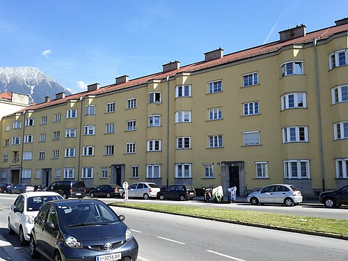
Innsbruck’s east is the flat part: Pradl and Amras lie on the valley floor, densely built and with far more flats than the slope. The green here is not on a mountain but strung out in chains, and the walk threads them together: from the Rapoldi park past the Pradl parish church to the Tivoli sports grounds and on out to the Ambras castle park, where the city ends at an old manorial garden. Forty minutes, and not a metre of climb that hurts.
Getting there: 2, 3, 5 to Innsbruck Leipziger Platz, 238 m to the start. Way back from Innsbruck Luigenstraße (C, N1), 231 m.
The route and its data
The coloured line is the walk, routed on the real pedestrian network. Toggle a data layer, or tap anywhere on the map to see trees, noise, heat and travel times for that exact spot.
Tap the numbered stops for what makes each spot special, or tap anywhere for the full “what’s here?”.
Every 100 metres of the route, classified from the real data: green spaces, the official noise map, footfall.
About 79 m of climbing and 8 m of descent, between 577 and 649 m above sea level. Sampled every 25 m from open elevation data.
For families and anyone who needs level ground. For sun the east is mid-range (Pradl 72, Amras 70 out of 100), but the whole route is flat and passable with a pram, unlike anything on the slope.
The green in the east comes in a chain, not in one piece: wide roads and sports grounds sit between the parks, and on match days at the Tivoli the area is full. Ambras itself is quiet, but the bus ride into the centre is noticeably longer than it looks from the map.
What changes along the way
Every 100 metres of the walk, sampled against wohnwahn’s data. The bars run from the start (left) to the finish (right). In short: lively and busy · very well connected.
Read this first: The green tile below measures how close the inhabited cells sit to large green spaces, and here that value runs low. That is exactly why this walk matters: it leads through the big green the surrounding homes lack.
Values are 0 to 100 per 250 m cell. Parks and water have no residential cell of their own, so those stretches read the nearest neighbourhood. Source: Innsbruck tree register, heat model from surface sealing, environmental noise map, footfall and own transit routing.
What’s along the way
Counted within about 140 metres of the route, from our data.
The stops
Homes along this walk
Real listings within about 350 metres of the route.
No listing sits right on this walk at the moment. Save a search and we’ll email you when one comes in. Search all homes →
The areas along this walk
The full profile of each area in the atlas: trees, quiet, prices, travel times.
About this walk
How long is the walk?
About 4.2 km, roughly 70 minutes at a normal pace, 5,300–6,100 steps. Routed on the real pedestrian network, not straight-line.
What do the data say about this route?
lively and busy · very well connected. Every figure is measured per 250 m cell and refreshed monthly.
Which neighbourhoods does it cross?
Pradl, Amras. Each links to its full profile in the neighbourhood atlas.
Walked it? Now find the flat.
Jump into the search along this route, or tap any address on the map to see the data before the viewing.
Search properties here →More on this topic →Explore the atlas →All walks →
Route routed on the OpenStreetMap pedestrian network (© OpenStreetMap contributors, ODbL) · map tiles © CARTO. Data profile: Innsbruck tree register, heat model from surface sealing, environmental noise map (BMK), footfall and own transit routing on the IVB and ÖBB timetables. Data as of 2026-09-08.