Skip to content
DEList a propertyFind a property
Shortlist

Living · Topic

Where can you live by the water in St. Pölten?

Water geometry from OpenStreetMap + a water-cooling score per 250 m cell

“By the water” is a favourite in every listing. wohnwahn measures it: 4,467 water features across St. Pölten and a cooling score per 250 m cell.

And we say honestly where the trade-offs are: the Traisen is regulated and narrow, and away from its banks there is no water nearby in St. Pölten.

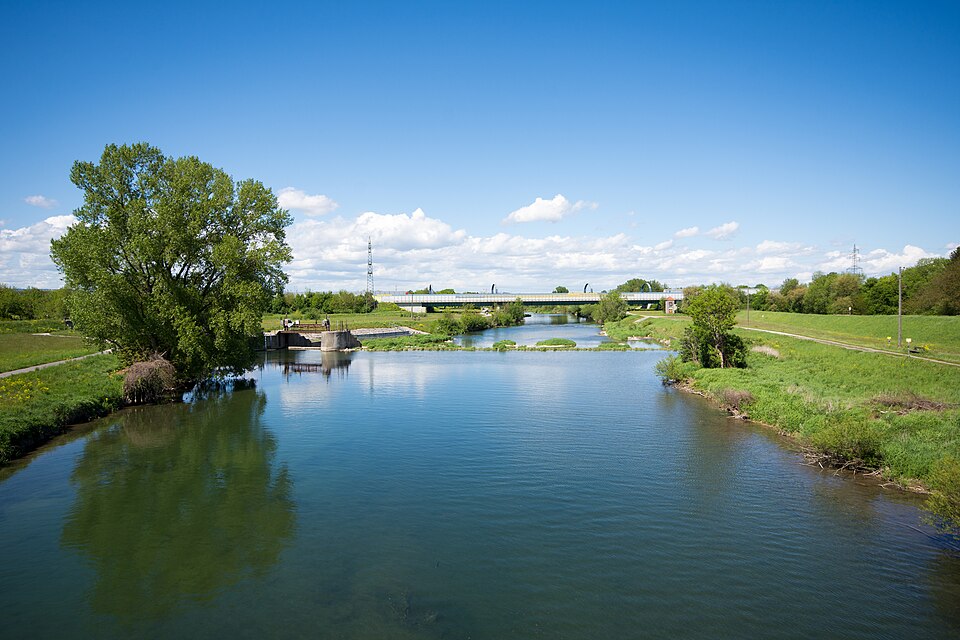
Traisen Harlander Bruecke, St. Pölten
Linie29 · CC BY-SA 4.0

Homes near the water

No waterside listings online right now.

Save a search and we’ll email you when a home near the water comes in.

Open the searchList a property (free)

The water map of St. Pölten

Deeper blue means closer to open water. Every square is an inhabited 250 m cell; the Traisen, the Mühlbach and the bathing ponds in the north count, culverted ditches and small brooks do not.

dryat the water

Only inhabited cells are coloured. This is a proximity model for the big open waters, NOT an official flood map. Tap the map for the water-proximity score at that exact spot.

What to check for a real waterside flat

The water view is the flat’s job, not the location’s

Our data shows how close and how cooling the water is around an address. Whether you actually see it depends on the floor, the orientation and the building, that’s what the listing and a viewing tell you.

The Traisen is not a bathing pond

The Traisen is a regulated river with a cycle path, good for walking and for the cooler air. The ponds in the north are for swimming, but they are further from the centre and crowded in summer.

The number is small, and that is the answer

Only a handful of areas score above zero at all. We show those instead of claiming a difference that does not exist: if you want water, look at these few strips, and for everywhere else this topic simply does not apply.

St. Pölten is not a city on the water

That is the most honest sentence on this page. In most parts of this market the score is zero, because there simply is no larger body of water nearby. Here a waterside location is the exception, not the feature you sort the city by.

Frequently asked questions

Where in St. Pölten can you live right by the water?

The evaluation is being computed.

Is living by the water a flood risk?

wohnwahn measures water proximity and cooling, not flood risk. The Traisen is regulated; anyone planning to live beside it should check the official hazard zone plan of Lower Austria.

The Traisen or the ponds in the north, what is the difference?

The Traisen runs through the city: cycle path, cooler air, central. The ponds in the north are for swimming, but they lie outside town and get busy on hot weekends.

Where do you live by the water AND close to the centre?

Several districts combine water proximity with good transit; the ranking above shows the trade-off.

How current is the water data?

Water geometry from OpenStreetMap, cooling score per inhabited 250 m cell, refreshed monthly.

More honest data on where to live well in St. Pölten and the surrounding area.

This topic inViennaGrazSalzburgLinzInnsbruckBregenzKlagenfurtEisenstadt

Find a home by the water, honestly.

Search, tap any address on the map, and see the water, the cooling, the noise and the travel times before the viewing. Free and independent.

Search homes →

Sources: water geometry OpenStreetMap · cooling effect: own model per 250 m cell · transit: own routing on the LUP St. Pölten and ÖBB timetables. Not an official flood map. Refreshed monthly.