Skip to content
DEList a propertyFind a property
Shortlist

Living · Topic

Where can you live by the water in Klagenfurt?

You live by the water in Maria Wörth, Krumpendorf am Wörthersee and Keutschach am See.

“By the water” is a favourite in every listing. wohnwahn measures it instead: 6,710 water features across Klagenfurt, from the Wörthersee to the Glan, and a cooling score per inhabited 250 m cell.

And we say honestly where the trade-offs are: the city itself is not on the lake, the lakeside municipalities cost more, and part of the shoreline neighbourhood is away in winter.
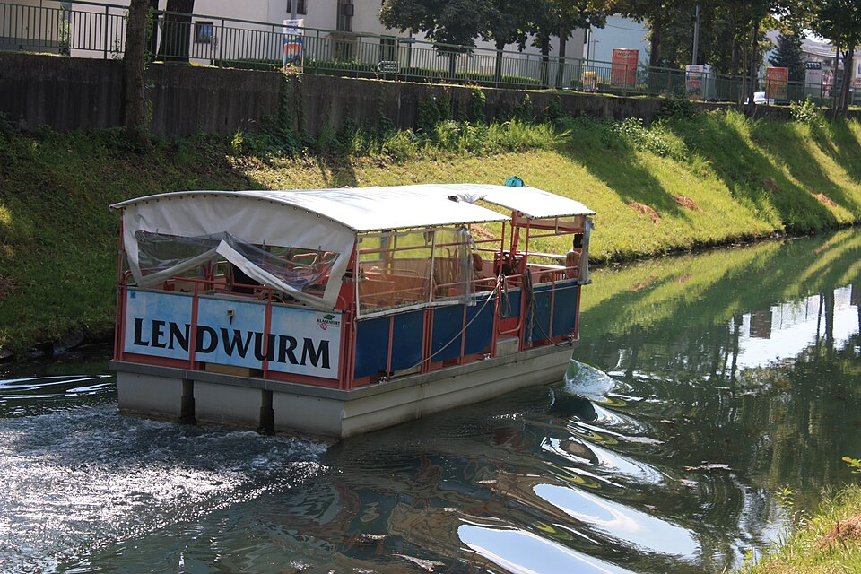
Klagenfurt Lendwurm5
JJ55 · Public domain

Where Klagenfurt lives by the water

Ranked by the share of residential spots near a big open water, so it rewards districts with many waterside homes, not a single luxury shoreline. Linked: the full profile in the atlas.

  1. 1Maria Wörth67 %homes near water
  2. 2Krumpendorf am Wörthersee40 %homes near water
  3. 3Keutschach am See36 %homes near water

Water geometry from OpenStreetMap + a water-cooling score per 250 m cell · as of: September 2026

  1. 4
    St. Martin
    water proximity 84/100· Heiligengeistplatz ≈ 14 Min
    22%homes near water
  2. 5
    Annabichl
    water proximity 52/100· Heiligengeistplatz ≈ 16 Min
    17%homes near water
  3. 6
    Völkermarkter Vorstadt
    water proximity 45/100· Heiligengeistplatz ≈ 9 Min
    17%homes near water
  4. 7
    Maria Rain
    water proximity 80/100· Heiligengeistplatz ≈ 44 Min· town
    16%homes near water
  5. 8
    Ferlach
    water proximity 70/100· Heiligengeistplatz ≈ 64 Min· town
    15%homes near water
  6. 9
    Köttmannsdorf
    water proximity 84/100· Heiligengeistplatz ≈ 34 Min· town
    12%homes near water
  7. 10
    Maria Saal
    water proximity 53/100· Heiligengeistplatz ≈ 28 Min· town
    12%homes near water
  8. 11
    Poggersdorf
    water proximity 50/100· Heiligengeistplatz ≈ 36 Min· town
    12%homes near water
  9. 12
    St. Veiter Vorstadt
    water proximity 40/100· Heiligengeistplatz ≈ 7 Min
    11%homes near water
  10. 13
    Ebenthal in Kärnten
    water proximity 51/100· Heiligengeistplatz ≈ 34 Min· town
    10%homes near water
  11. 14
    St. Veit an der Glan
    water proximity 54/100· Heiligengeistplatz ≈ 36 Min· town
    10%homes near water
  12. 15
    Hörtendorf
    water proximity 55/100· Heiligengeistplatz ≈ 24 Min
    10%homes near water
  13. 16
    Viktring
    water proximity 45/100· Heiligengeistplatz ≈ 21 Min
    9%homes near water
  14. 17
    St. Peter
    water proximity 43/100· Heiligengeistplatz ≈ 16 Min
    9%homes near water
  15. 18
    Moosburg
    water proximity 62/100· Heiligengeistplatz ≈ 36 Min· town
    7%homes near water
  16. 19
    Magdalensberg
    water proximity 49/100· Heiligengeistplatz ≈ 34 Min· town
    7%homes near water
  17. 20
    Wölfnitz
    water proximity 52/100· Heiligengeistplatz ≈ 27 Min
    5%homes near water
  18. 21
    St. Ruprecht
    water proximity 41/100· Heiligengeistplatz ≈ 18 Min
    1%homes near water
  19. 22
    Villacher Vorstadt
    water proximity 0/100· Heiligengeistplatz ≈ 8 Min
    0%homes near water
  20. 23
    Liebenfels
    water proximity 0/100· Heiligengeistplatz ≈ 52 Min· town
    0%homes near water

Method: proximity to the big open waters per inhabited 250 m cell (the Wörthersee, the Lendkanal, the Glan and the bathing lakes around the city count), bigger and closer water weighs more, share of cells above the threshold, clipped to the real boundary. Channelled races and small brooks are deliberately excluded, they don’t make a waterside home. A district scores high when many homes sit near water, not because of one exclusive shore.

Homes near the water

No waterside listings online right now.

Save a search and we’ll email you when a home near the water comes in.

Open the searchList a property (free)

The water map of Klagenfurt

Deeper blue means closer to open water. Every square is an inhabited 250 m cell; the Wörthersee, the Lendkanal, the Glan and the bathing lakes around the city count, culverted brooks and narrow ditches do not.

dryat the water

Only inhabited cells are coloured. This is a proximity model for the big open waters, NOT an official flood map. Tap the map for the water-proximity score at that exact spot.

By the water and still central

Water usually means the edge of the city. These places prove otherwise: many waterside homes AND within 20 minutes of Heiligengeistplatz by transit (St. Martin is the classic).

What to check for a real waterside flat

The water view is the flat’s job, not the location’s

Our data shows how close and how cooling the water is around an address. Whether you actually see it depends on the floor, the orientation and the building, that’s what the listing and a viewing tell you.

The city is not on the lake

That is the most important sentence on this page. In the districts of Klagenfurt between 0 and 22 per cent of homes sit near water; in the lakeside municipalities it is 36 to 67. Anyone who wants the Wörthersee on the doorstep looks in Maria Wörth, Krumpendorf or Keutschach, not in the Innere Stadt.

The lake costs travel time

The three leading places are 23 to 33 transit minutes from the centre, while the city districts with water are 8 to 16. On the lake you pay for the water with the journey, and that is a trade-off worth deciding consciously.

The Lendkanal is the way to the lake, not the lake

The Lendkanal connects the city with the Wörthersee, and living on it is a different thing from living on the shore: a narrow, quiet water with an avenue beside it rather than a bathing place with a long view. "By the water" in a listing can mean either, and the map says which.

Frequently asked questions

Where in Klagenfurt can you live right by the water?

By share of waterside homes it is Maria Wörth (67% of residential spots near water), followed by Krumpendorf am Wörthersee and Keutschach am See. The classic addresses are on the lake: Maria Wörth, Krumpendorf and Keutschach. Inside the city, St. Martin leads. Source: OpenStreetMap water geometry, evaluated per 250 m cell.

Is living by the water a flood risk?

wohnwahn measures water proximity and cooling, not flood risk. For a binding statement per address the official HORA hazard map is the reference; we do not issue a flood-risk rating.

Wörthersee or Lendkanal, what is the difference?

The Wörthersee is bathing water with a long view; shoreline plots are scarce and expensive, and the season shapes the neighbourhood. The Lendkanal is a quiet, narrow water in the middle of the city, with an avenue and a cycle path. Both are "by the water", and they live completely differently.

Where do you live by the water AND close to the centre?

St. Martin for example: many waterside homes and still ≈ 14 minutes from Heiligengeistplatz by transit. St. Martin is the textbook case: waterside spots in the district and still 14 minutes by transit into the Innere Stadt.

How current is the water data?

Water geometry from OpenStreetMap, cooling score per inhabited 250 m cell, refreshed monthly (as of September 2026).

More honest data on where to live well in Klagenfurt and the surrounding area.

This topic inViennaGrazSalzburgLinzSt. PöltenInnsbruckBregenzEisenstadt

Find a home by the water, honestly.

Search, tap any address on the map, and see the water, the cooling, the noise and the travel times before the viewing. Free and independent.

Search homes →

Sources: water geometry OpenStreetMap · cooling effect: own model per 250 m cell · transit: own routing on the Kärntner Linien and ÖBB timetables. Not an official flood map. Refreshed monthly.