Skip to content
DEList a propertyFind a property
Shortlist

Living · Topic

Where can you live by the water in Bregenz?

You live by the water in Gaißau, Rieden-Weidach and Mehrerau.

“By the water” is a favourite in every listing. wohnwahn measures it instead: 19,661 water features across Bregenz, from Lake Constance to the Alter Rhein, and a cooling score per inhabited 250 m cell.

And we say honestly where the trade-offs are: the lake is a narrow strip, the valley is criss-crossed by ditches that are no waterside at all, and being on the shore is no guarantee, Lochau lies on the lake and still reaches only 8 per cent.
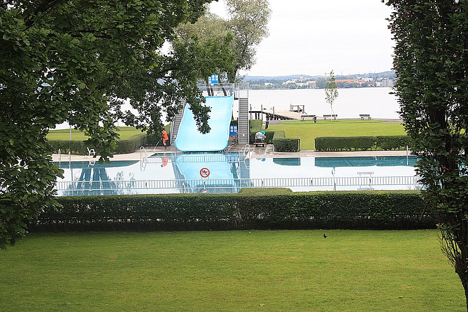
Bregenz, the open air bath
Dguendel · CC BY 3.0

Where Bregenz lives by the water

Ranked by the share of residential spots near a big open water, so it rewards districts with many waterside homes, not a single luxury shoreline. Linked: the full profile in the atlas.

  1. 1Gaißau85 %homes near water
  2. 2Rieden-Weidach70 %homes near water
  3. 3Mehrerau65 %homes near water

Water geometry from OpenStreetMap + a water-cooling score per 250 m cell · as of: September 2026

  1. 4
    Schendlingen
    water proximity 74/100· Bregenz station ≈ 8 Min
    61%homes near water
  2. 5
    Hard
    water proximity 83/100· Bregenz station ≈ 19 Min· town
    54%homes near water
  3. 6
    Kennelbach
    water proximity 85/100· Bregenz station ≈ 14 Min· town
    51%homes near water
  4. 7
    Fußach
    water proximity 76/100· Bregenz station ≈ 26 Min· town
    40%homes near water
  5. 8
    Hörbranz
    water proximity 71/100· Bregenz station ≈ 22 Min· town
    36%homes near water
  6. 9
    Sulz
    water proximity 49/100· Bregenz station ≈ 41 Min· town
    32%homes near water
  7. 10
    Zentrum
    water proximity 79/100· Bregenz station ≈ 4 Min
    30%homes near water
  8. 11
    Höchst
    water proximity 86/100· Bregenz station ≈ 30 Min· town
    30%homes near water
  9. 12
    Hohenweiler
    water proximity 70/100· Bregenz station ≈ 33 Min· town
    27%homes near water
  10. 13
    Vorkloster
    water proximity 90/100· Bregenz station ≈ 6 Min
    26%homes near water
  11. 14
    Altach
    water proximity 68/100· Bregenz station ≈ 37 Min· town
    24%homes near water
  12. 15
    Buch
    water proximity 57/100· Bregenz station ≈ 31 Min· town
    24%homes near water
  13. 16
    Feldkirch
    water proximity 75/100· Bregenz station ≈ 56 Min· town
    23%homes near water
  14. 17
    Röthis
    water proximity 45/100· Bregenz station ≈ 41 Min· town
    23%homes near water
  15. 18
    Andelsbuch
    water proximity 56/100· Bregenz station ≈ 50 Min· town
    22%homes near water
  16. 19
    Lustenau
    water proximity 81/100· Bregenz station ≈ 37 Min· town
    21%homes near water
  17. 20
    Wolfurt
    water proximity 83/100· Bregenz station ≈ 17 Min· town
    20%homes near water
  18. 21
    Koblach
    water proximity 68/100· Bregenz station ≈ 43 Min· town
    20%homes near water
  19. 22
    Mäder
    water proximity 89/100· Bregenz station ≈ 45 Min· town
    20%homes near water
  20. 23
    Doren
    water proximity 52/100· Bregenz station ≈ 71 Min· town
    19%homes near water
  21. 24
    Lauterach
    water proximity 69/100· Bregenz station ≈ 17 Min· town
    18%homes near water
  22. 25
    Meiningen
    water proximity 63/100· Bregenz station ≈ 67 Min· town
    16%homes near water
  23. 26
    Frastanz
    water proximity 61/100· Bregenz station ≈ 53 Min· town
    16%homes near water
  24. 27
    Fluh
    water proximity 66/100· Bregenz station ≈ 22 Min
    15%homes near water
  25. 28
    Alberschwende
    water proximity 58/100· Bregenz station ≈ 33 Min· town
    12%homes near water
  26. 29
    Dornbirn
    water proximity 50/100· Bregenz station ≈ 32 Min· town
    11%homes near water
  27. 30
    Rankweil
    water proximity 50/100· Bregenz station ≈ 46 Min· town
    10%homes near water
  28. 31
    Hohenems
    water proximity 74/100· Bregenz station ≈ 33 Min· town
    9%homes near water
  29. 32
    Lochau
    water proximity 85/100· Bregenz station ≈ 21 Min· town
    8%homes near water
  30. 33
    Schwarzenberg
    water proximity 55/100· Bregenz station ≈ 66 Min· town
    8%homes near water
  31. 34
    Zwischenwasser
    water proximity 51/100· Bregenz station ≈ 62 Min· town
    8%homes near water
  32. 35
    Egg
    water proximity 53/100· Bregenz station ≈ 43 Min· town
    6%homes near water
  33. 36
    Lingenau
    water proximity 60/100· Bregenz station ≈ 54 Min· town
    6%homes near water
  34. 37
    Ölrain
    water proximity 80/100· Bregenz station ≈ 10 Min
    3%homes near water
  35. 38
    Götzis
    water proximity 45/100· Bregenz station ≈ 36 Min· town
    1%homes near water
  36. 39
    Sulzberg
    water proximity 0/100· Bregenz station ≈ 42 Min· town
    0%homes near water

Method: proximity to the big open waters per inhabited 250 m cell (Lake Constance, the Bregenzer Ache, the Alter Rhein and the gravel lakes count), bigger and closer water weighs more, share of cells above the threshold, clipped to the real boundary. Channelled races and small brooks are deliberately excluded, they don’t make a waterside home. A district scores high when many homes sit near water, not because of one exclusive shore.

Homes near the water

No waterside listings online right now.

Save a search and we’ll email you when a home near the water comes in.

Open the searchList a property (free)

The water map of Bregenz

Deeper blue means closer to open water. Every square is an inhabited 250 m cell; Lake Constance, the Bregenzer Ache, the Alter Rhein and the gravel lakes count, the drainage ditches of the Rhine valley do not.

dryat the water

Only inhabited cells are coloured. This is a proximity model for the big open waters, NOT an official flood map. Tap the map for the water-proximity score at that exact spot.

By the water and still central

Water usually means the edge of the city. These places prove otherwise: many waterside homes AND within 20 minutes of Bregenz station by transit (Rieden-Weidach is the classic).

What to check for a real waterside flat

The water view is the flat’s job, not the location’s

Our data shows how close and how cooling the water is around an address. Whether you actually see it depends on the floor, the orientation and the building, that’s what the listing and a viewing tell you.

Lakeside is not the same as on the lake

Lochau is the case that proves it: the municipality lies directly on Lake Constance and still only 8 per cent of its inhabited cells are near water, because the settlement climbs the Pfänder slope. Inside Bregenz the split is just as sharp: Rieden-Weidach 70 per cent, Mehrerau 65, Schendlingen 61, but the centre 30, Vorkloster 26 and Ölrain 3.

The Rhine delta is not the lake

Gaißau leads the whole market with 85 per cent, but its water is the Alter Rhein and the delta, not the open lake: flat, quiet, close to the Swiss border and 37 transit minutes from Bregenz. That is a different life from the shore promenade.

Most waters in the Rhine valley are ditches

Of the 19,661 water features in this market 17,806 are lines, that is rivers, brooks and above all the drainage ditches of the Rhine valley, against only 1,855 areas. "By the water" here often means "by the ditch". The map shows which one is meant.

Frequently asked questions

Where in Bregenz can you live right by the water?

By share of waterside homes it is Gaißau (85% of residential spots near water), followed by Rieden-Weidach and Mehrerau. The classic addresses are Gaißau in the Rhine delta and, inside Bregenz, Rieden-Weidach, Mehrerau and Schendlingen on the lake. Source: OpenStreetMap water geometry, evaluated per 250 m cell.

Is living by the water a flood risk?

wohnwahn measures water proximity and cooling, not flood risk. For a binding statement per address the official HORA hazard map is the reference; we do not issue a flood-risk rating.

Lake Constance or the Bregenzer Ache, what is the difference?

The lake is wide open water with a long view, a promenade and summer crowds; the Ache is a mountain river with wooded banks that stays cool and is far quieter. Hard and Kennelbach show both sides: Hard on the lake, Kennelbach on the river, and they live completely differently.

Where do you live by the water AND close to the centre?

Zentrum for example: many waterside homes and still ≈ 4 minutes from Bregenz station by transit. Rieden-Weidach is the textbook case: 70 per cent of homes near water and still nine minutes by transit into the centre.

How current is the water data?

Water geometry from OpenStreetMap, cooling score per inhabited 250 m cell, refreshed monthly (as of September 2026).

More honest data on where to live well in Bregenz and the surrounding area.

This topic inViennaGrazSalzburgLinzSt. PöltenInnsbruckKlagenfurtEisenstadt

Find a home by the water, honestly.

Search, tap any address on the map, and see the water, the cooling, the noise and the travel times before the viewing. Free and independent.

Search homes →

Sources: water geometry OpenStreetMap · cooling effect: own model per 250 m cell · transit: own routing on the Stadtbus Bregenz, Landbus and ÖBB timetables. Not an official flood map. Refreshed monthly.