3D map by Google
The 3D view is served by Google. Loading it transmits your IP address and technical data about your device to Google.
Your choice applies to this visit. Privacy policy
Everyday
Wilten: hot in summer, shaded in winter, and popular all the same
What do you get in return for the most difficult spot, climatically speaking?
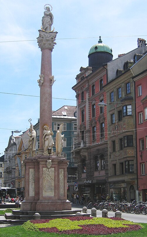
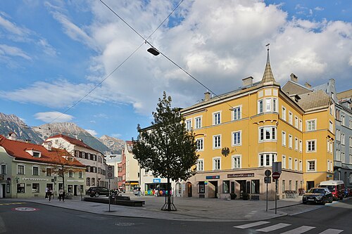
Wilten sits on the valley floor at the city’s southern edge, between the main station and the Bergisel, and it gets both drawbacks of the flat: the heat pools, and the mountains to the south take the winter sun. Our measurements say 58 out of 100 for sun and one of the lowest coolness values in the city. Against that stands what fills the district anyway: pubs, student flats, two abbeys and the station, all on foot. The walk runs from the station across the Wiltener Platzl to the basilica and the abbey and ends up on the Bergisel, where you can see the ridge that causes all of it.
Getting there: S4, REX2, S3 to Innsbruck Hauptbahnhof, 15 m to the start. Way back from Innsbruck Sonnenburgerhof (STB, 590, 589, 401, 591), 463 m.
The route and its data
The coloured line is the walk, routed on the real pedestrian network. Toggle a data layer, or tap anywhere on the map to see trees, noise, heat and travel times for that exact spot.
Tap the numbered stops for what makes each spot special, or tap anywhere for the full “what’s here?”.
Every 100 metres of the route, classified from the real data: green spaces, the official noise map, footfall.
About 153 m of climbing and 3 m of descent, between 581 and 732 m above sea level. Sampled every 25 m from open elevation data.
For students, early-career professionals and anyone who values short distances above afternoon sun. If you are looking at a south-facing ground floor here, view it in December, not in June.
Quiet measures mixed here, and that average misleads in both directions: the Platzl is loud in the evening, two lanes away the abbey garden is very still. Add the railway and the Brenner axis. If you are viewing a ground or first floor here, do it between November and February, when the southern ridge takes the most.
What changes along the way
Every 100 metres of the walk, sampled against wohnwahn’s data. The bars run from the start (left) to the finish (right). In short: lively and busy · very well connected.
Values are 0 to 100 per 250 m cell. Parks and water have no residential cell of their own, so those stretches read the nearest neighbourhood. Source: Innsbruck tree register, heat model from surface sealing, environmental noise map, footfall and own transit routing.
What’s along the way
Counted within about 140 metres of the route, from our data.
The stops
Homes along this walk
Real listings within about 350 metres of the route.
 110 m from the routeWiltenNice investment property 960/10000 shares with non-partitioned but 2 assigned apartments and underground parking spaces Wilten€ 345,000 · 83.7 m²
 160 m from the routeInnenstadtTop studio apartment with terrace in the heart of Innsbruck rented until 2029: Mentlgasse 16 KP 249,000on request · 1 rm · 42 m²
The areas along this walk
The full profile of each area in the atlas: trees, quiet, prices, travel times.
About this walk
How long is the walk?
About 3.4 km, roughly 65 minutes at a normal pace, 4,300–4,900 steps. Routed on the real pedestrian network, not straight-line.
What do the data say about this route?
lively and busy · very well connected. Every figure is measured per 250 m cell and refreshed monthly.
Which neighbourhoods does it cross?
Innenstadt, Wilten. Each links to its full profile in the neighbourhood atlas.
Walked it? Now find the flat.
Jump into the search along this route, or tap any address on the map to see the data before the viewing.
Route routed on the OpenStreetMap pedestrian network (© OpenStreetMap contributors, ODbL) · map tiles © CARTO. Data profile: Innsbruck tree register, heat model from surface sealing, environmental noise map (BMK), footfall and own transit routing on the IVB and ÖBB timetables. Data as of 2026-09-08.