3D map by Google
The 3D view is served by Google. Loading it transmits your IP address and technical data about your device to Google.
Your choice applies to this visit. Privacy policy
Official city hiking trail 12
City hiking trail 12: Wienerberg
The longest loop: ponds, meadows and long views in the south.
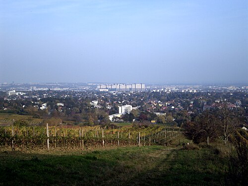
The big southern loop, the longest of the series: across the Wienerberg with its ponds and meadows, through recreation areas between Favoriten and Meidling, with ever-changing views of the skyline. Local nature where few expect it.
Getting there: 11, N65 to Wien Wienerfeldgasse, 254 m to the trailhead. Way back from Wien Inzersdorf, Kirchenplatz (16A), 119 m.
The official route and its data
The coloured line is the official route by the City of Vienna, unchanged. Toggle a data layer, or tap anywhere on the map to see trees, noise, heat and travel times for that exact spot.
Tap anywhere on the map for the full “what’s here?” of that spot.
About 87 m of climbing and 111 m of descent, between 184 and 237 m above sea level. Sampled every 25 m from open elevation data; walking time uses the standard hiking formula (4 km/h plus 300 m of climb per hour).
For the fit and the south-Vienna-curious: the trail links residential areas that otherwise never appear in one sentence.
Almost 20 kilometres: this is a full-day stage, not an afternoon stroll. The route can be cut short at several transit points, though.
What changes along the way
Every 200 metres of the trail, sampled against wohnwahn’s data. The curves run from the start (left) to the finish (right). In short: 72% green along the built-up stretches.
Values are 0 to 100 per 250 m residential cell. Forest and fields have no cells, so the profile honestly pauses there; curves only appear once they cover at least half the trail. Source: official urban climate analysis, environmental noise map, green-space proximity, footfall and own transit routing.
What’s along the way
Counted within about 140 metres of the route, from our data.
Living along this trail
Real listings within about 500 metres of the route: local recreation from your own front door.
 200 m from the route1230 LiesingLiventi Townhouses€ 699,000 · 4 rm · 94.7 m²
 200 m from the route1230 LiesingLiventi Townhouses€ 650,000 · 4 rm · 79.8 m²
 200 m from the route1230 LiesingPerfect home for couples in need of space! Climate-active Gold certification!€ 449,000 · 3 rm · 69.2 m²
 200 m from the route1230 LiesingHome with Quality of Life in Vienna-Liesing€ 439,000 · 3 rm · 69.2 m²
 200 m from the route1230 LiesingCompact 2-Room Freehold Apartment with Feel-Good Factor€ 279,000 · 2 rm · 47.3 m²
 200 m from the route1230 LiesingGarden apartment with 2 terraces and plenty of space for the whole family!€ 579,000 · 4 rm · 85.7 m²
The areas along this trail
The full profile of each area in the atlas: trees, quiet, prices, travel times.

About this trail
How long is city hiking trail 12?
About 20.8 km on the official route, with roughly 87 m of climbing. We calculate about 5:20 h of walking using the standard hiking formula (4 km/h plus 300 m of climb per hour): no official time is published.
How do I get to the trailhead by public transport?
11, N65 to Wien Wienerfeldgasse, 254 m to the trailhead. The way back runs from Wien Inzersdorf, Kirchenplatz (16A).
Is this the official route?
Yes. The line is the official city hiking trail 12 by the City of Vienna (open data, CC BY 4.0), unchanged: we only joined the published segments and added our own data on top.
Which districts does it cross?
Favoriten, Liesing, Vösendorf. Each links to its full profile in the neighbourhood atlas.
Hiked it? This could be your local trail.
Search homes along the route, or explore each area in the atlas: the data before the viewing.
Search homes here →Explore the atlas →Shorter? The neighbourhood walks →All 14 trails →
Route: City of Vienna, data.gv.at (WANDERWEGEOGD, CC BY 4.0), unchanged; segments joined. Map tiles © OpenStreetMap, © CARTO. Elevation: Austria terrain data © offene Daten Österreichs – Digitales Geländemodell (DGM) Österreich; walking time calculated (standard hiking formula), not an official figure. Data profile: official urban climate analysis, environmental noise map (BMK), green-space proximity, footfall and own transit routing on the Wiener Linien and ÖBB timetables. Data as of 2026-09-03.